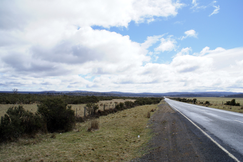
Driving back to Devonport, I decided to take
the route
through the Tasmanian Highlands instead of the lower elevation route I
took
when I was heading south. Here you can see the highway leading to
the
highlands.
As I went along the landscape became more rugged and hilly. Some
scrubby
pines were also growing in some areas.
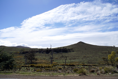
Here you can see some of the farmland that
is in use in the
highlands. There were mainly grazing animals, predominantly
cattle.
As I was driving along I noticed two people on ATV's driving
erratically on the
road ahead of me. One of them stopped and waved his hands in the
air, as
I got closer. As I slowed down I saw a young calf running around
with the
two ATV cowboys trying to herd it into an open gate. I don't know
if they
ever got the calf back into the field, but it was looking promising for
them as
they disappeared in my rear-view mirror.
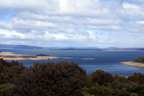
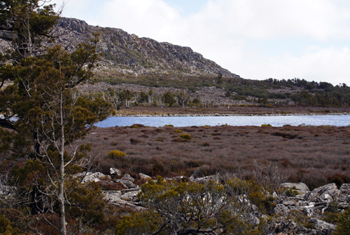
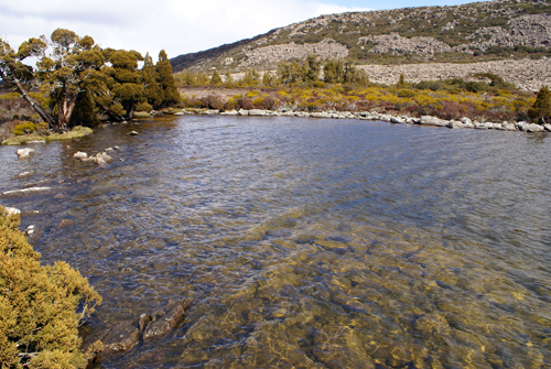
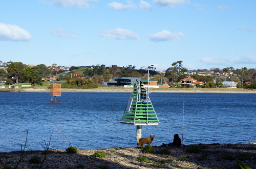
Below you can see two views of the great highland lake. It really
is very
big being at least a few kilometres long. There were lots of
ramps down
to the lake so I think during the summer there would be lots of
activity.
Around the lake there are lots of little towns and villages, almost all
of
which have a few motels so tourism is probably what helps keep the
economy
alive.
After driving up hill for an hour or so I
reached the peak
and started to head down hill towards Devonport on the north
coast.
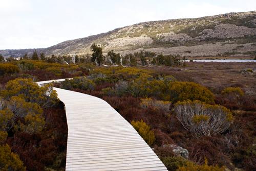
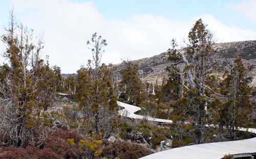
Traveling along the A5 I had been driving for about 30 km on a gravel
road when
I came across a boardwalk towards Pine Lake.
The trail was about 500 meters, one way, and built and maintained by
the
National Heritage Trust of Australia. This part of the Central
Plateau is
also part of Tasmania's Wilderness World Heritage Area. Nowhere
else is
it as easy to see ancient pencil pines and such a variety of alpine
plants,
many of which are found only in Tasmania. The walk also took me
through a
number of different plant communities including bolster, or cushion
plant
communities, block streams, where plants are protected from the ravages
of
fire, and herb fields.
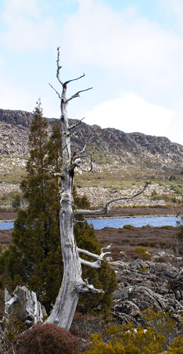
The signs also informed me that I could experience one of the harshest
climates
in Tasmania. Although you can see some sun on the surrounding
hills in
this picture, by the time I was half way through the walk I had got
very windy
and started to snow.
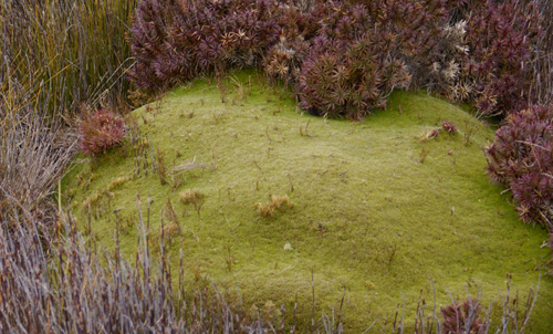
Conditions on the Central Plateau are
harsh. Snow and
frost can occur at any time of the year and in spring the plateau is
exposed to
the full force of the Roaring Forties. The winds have both a
drying and
cooling effect so plants have developed ways to conserve moisture and
survive
the long, cold winters. Many plants are small and compact, which
means
they are less likely to be damaged by wind, ice, storms or heavy
snow.
Some, like this cushion plant, form a densely packed cushion shape,
which acts
as a heat bank and protects the individual plants and their roots from
low
temperatures. However, because of their slow growth they are very
easily
damaged and may take years to recover. This cushion plant is over
100
years old.
The purplish plant at the top of the picture with the small off white
flowers
is Lemon-scented boronia (Boronia citiodora).
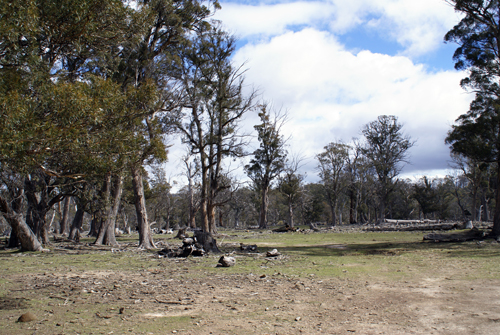
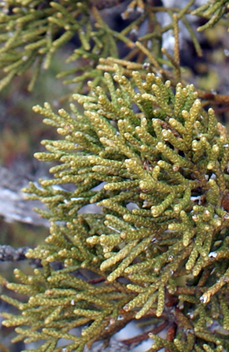
The dominant trees here are Pencil Pines. They are one of the most frost-resistant trees in Australia. These pencil pines are found only in Tasmania, but they belong to the same family as the tallest tree in the world, the giant California Sequoia. They have their origins on the southern continent of Gondwana and are among the great survivors of the aeons of ravaging change.
Despite these ancient origins and having survived several ice ages they are not in a very vulnerable position. They are extremely fire-sensitive and large numbers have been killed by past burning practices and escaped campfires. They are, therefore, vulnerable even in protected areas such as national parks.
Looking at the leave one sees that they have been reduced to small scales, which wrap tightly around the branchlets. This reduces heat and moisture loss, which enables pencil pines to survive in a climate, which would kill most other trees. It probably helped them survive during the last Ice Age.
On the ends of some branchlets you may also see small cones. They release seed only about once every seven years. Many new pencil pines, however, have sprouted from the roots of older trees. A large number of young trees means that this is a healthy population, but in many areas of the Central Plateau rabbits, wallabies and wombats have eaten most of the young trees.
Pencil Pines are extremely slow growing. The smaller trees here are already over 50 years old, whereas the older trees above are almost 1,000 years old. On some of the old trees, lichens hang like beards from the branches, and forests of moss and fungi grow on their trunks. This reminded me a lot of the moss that grows on the trees in the southern states of the USA.
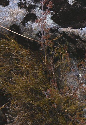
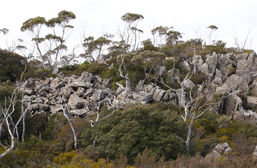
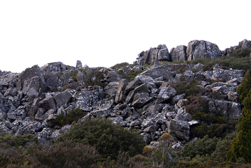
Block streams provide an important clue to Tasmania's past. They were formed during past ice ages in areas that were not covered by glaciers. Water seeped into the cracks and joints in the dolerite rock and at night froze and expanded. This enlarged the joints and eventually broke off large blocks of rock, which slowly migrated downhill. In high exposed areas, such as the Central Plateau, this process is still going on.
Block streams provide an important refuge for fire-sensitive plants, such as pencil pines and plum pines. There is very little fuel to burn, so the plants which manage to live here are protected. The crevices between the rocks are an important habitat for ferns and club moss.
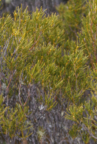
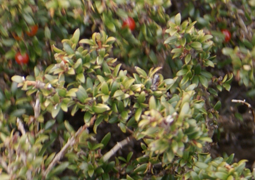
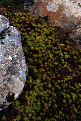
In summer you may see small skinks basking on the rocks to warm up. These are snow skinks, which are found only in the alpine areas of Tasmania. Plants also need heat so you will find many creeping plants, such as the alpine baeckea or the creeping tea-tree, hugging the rocks for warmth. The green and black colours on the rocks are complex lichen communities.
Below left, yellow bush.
Below right, Alpine baeckea.
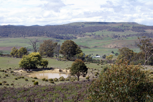
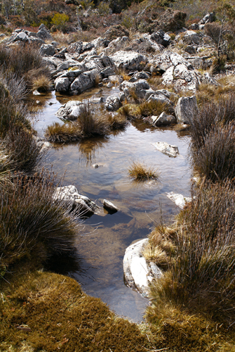
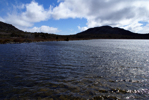
What you see around the lake is evidence of past glaciations. During the last Ice Age, which ended only about 10,000 years ago, it is likely that Pine Lake was on the edge of glacial activity. Temperatures were about 5 to 8 degrees Celsius cooler than today, but even now this is a harsh place to live. Many plants and animals are close to the edge of their physical limits and need special strategies just to survive.
If time and weather allow, this is a good place to sit and let Pine Lake share some of its secrets. Trout occasionally surface to catch insets, and flame robins sometime perch in the pencil pines. In the distance the trumpeting of curawongs can usually be heard and high above the hills it might be possible t see wedge-tailed eagles soaring on the thermal air currents.
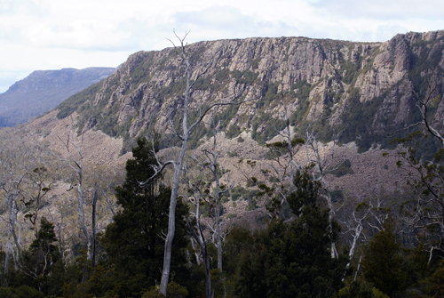
Departing the Central Plateau highlands there is lots of evidence of past glaciation. I found the north face much steeper than the south face.
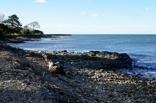
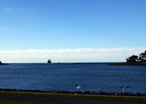

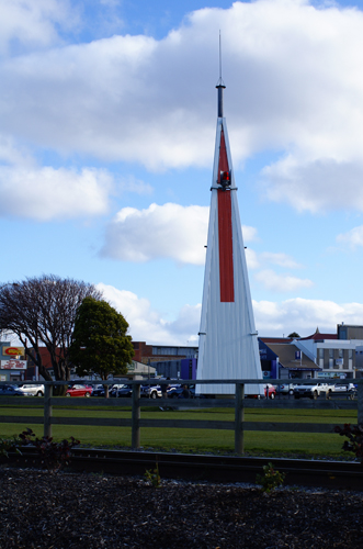
Along the shoreline of the harbour this large structure dominates the surrounding buildings and trees. Some may think it a large sculpture, but the navigators in the crowd should recognize it as the upper part of the entrance transit. I will admit that this is one of the most stylized transits I've seen. Usually they are simply a poll with a light and a painted board.
Behind the transit you can see the shopping district in downtown Devonport.
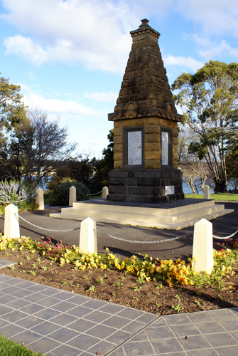
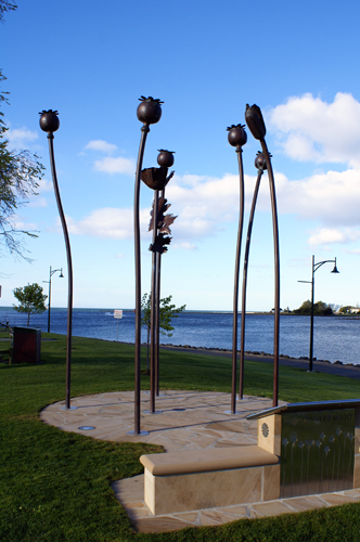
Along the harbour front is the local war memorial (below left), and a memorial to celebrate the pioneer of the Tasmanian Poppy Industry, Stephen King. The Tasmanian Poppy industry now supplies approximately 50% of the World's medicinal morphine, codeine and thebaine. Poppy cultivation is one of the major industries in the state, and Tasmania is internationally recognised as having the highest assays and highest alkaloid yields per hectare.
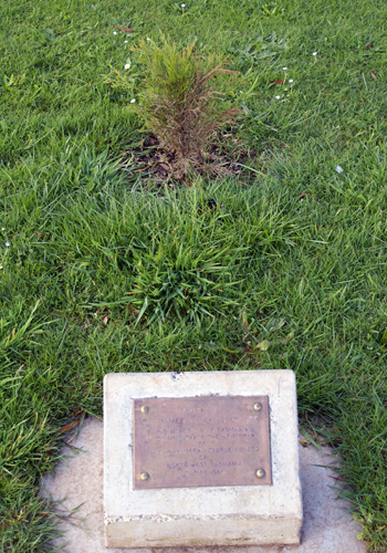
Okay, as a reservist, I couldn't help this one. To the left is a small seedling tree that almost is blends into the surroundings grass. The plaque reads: "Planted by Sir James Plimsoil, CBE, the Governor of Tasmania, to commemorate the centenary of the volunteer Defence Forces of North West Tasmania, 31 May 1986." If you are a reservist you will understand the irony, if not, best move on to the next picture.
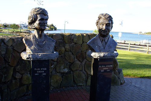
Below left is the Lyons Tribute erected in tribute to Rt. Hon. J.A. (Joe) Lyons, Premier of Tasmania 1923-1928, and Prime Minister of Australia from 6th January 1932 to his death on 7th April 1939 and his wife, Dame Enid Lyons, the first woman elected to the House of Representatives (1943) and the first woman appointed to the Australian Federal Cabinet (1949).
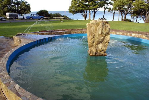
Below right, is a water fountain that also doubles as a sundial. The water jets cast a shadow on the stone surface of the stone that lets you know what time it is.
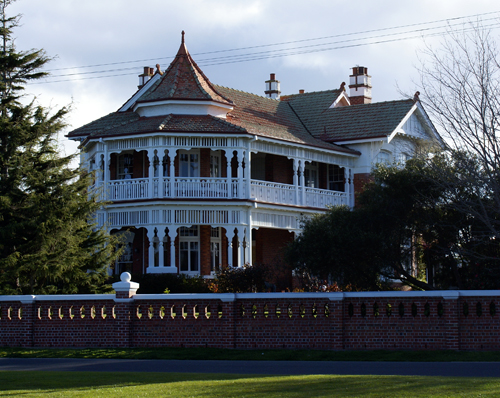
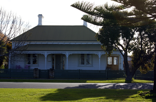
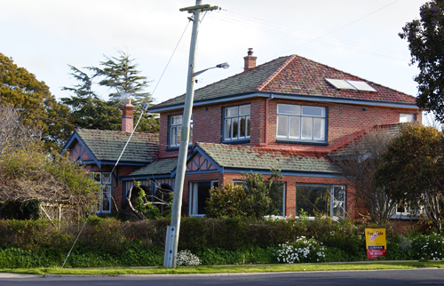
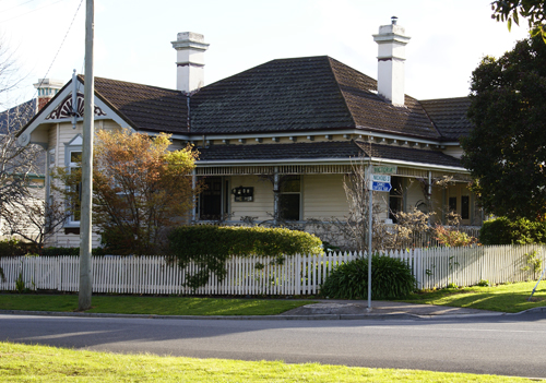
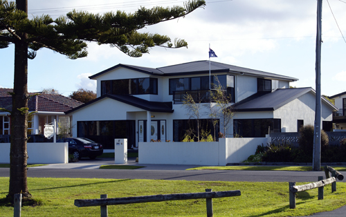
Further along the waterfront the expensive houses start to appear. Here is a sampling of some of the various architectural styles that appear.
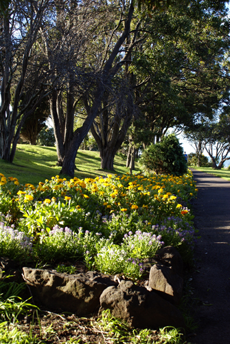
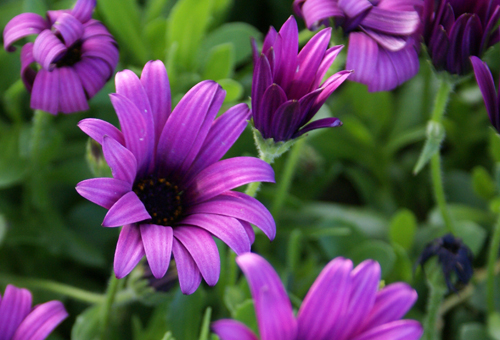
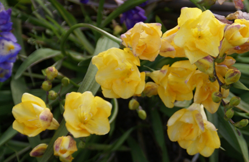
In the water front park there were also some early spring flowers in bloom.
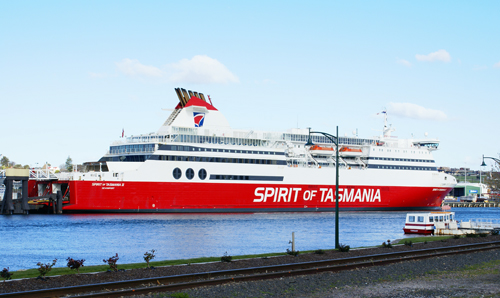
Finally it was time to head to the ferry, Spirit of Tasmania II and head back to Melbourne.