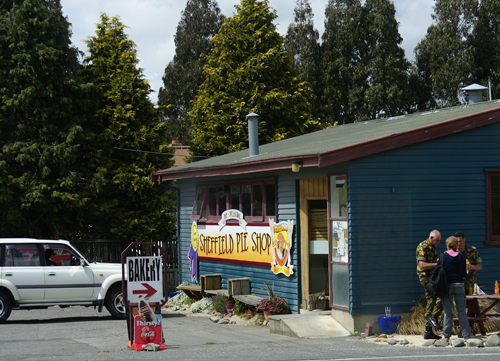
One of us spotted two New Zealand Military Policemen, and she went over to market the ABCA programme by trying to trade an ABCA coin for a military police coin. She returned satisfied with her trade.
A few km after Sheffield we entered the foothills of the Souther Alps and started our 945m clime to Arthur's Pass
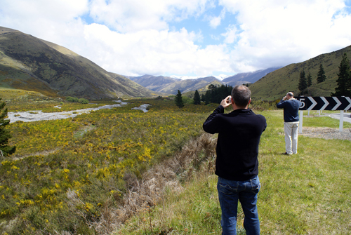
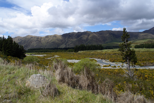

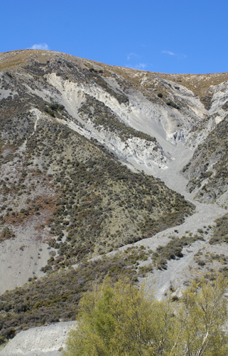
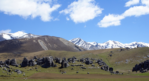
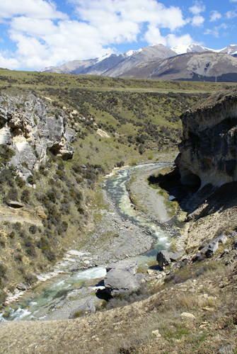
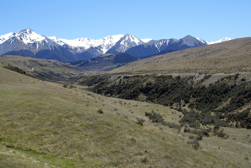
Further into the mountains one arrives as Castle Hill. The large limestone rock formation of Castle Hill is very popular with rock climbers. The area has historical significant to the Maori as a seasonal food-gathering spot and as part of the route used by Maori to reach the West Coast.
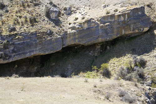
Both the cave and the grey and white rocks are typical of a limestone landscape. Thousands of years of weather by wind and water have shaped the most resistant limestone rocks into the castles and rampart that give the basin its name.
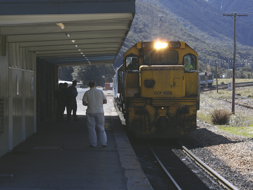
We stopped here and had a nice lunch of pies and some drinks before hitting the road again to make it to Arthur's Pass in for the train.
In the distance, the Torlesse mountain range is made up of greywacke, and old and hard rock. From Gorge Hill (just behind the rock mound behind me) and stretching to the left are the remains of what was a sheet of limestone, a much younger and softer rock that once covered this area. This layer was tilted when the surrounding ranges thrust up through it to form the basin.
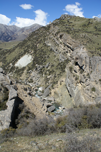
Here you can also see the Broken River gorge and some of the river. Below Right you can see where Cave Stream exits the cave and joins the Broken River.
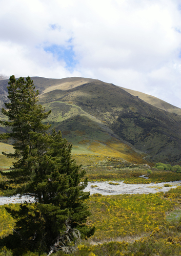
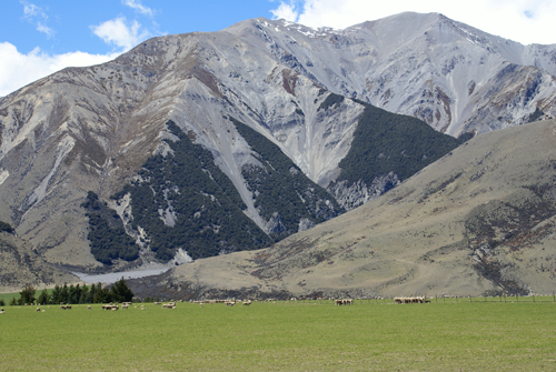
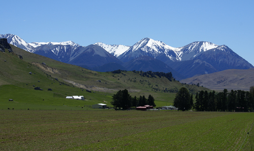
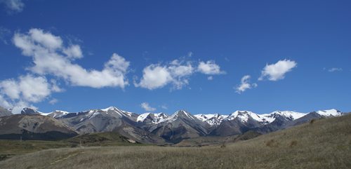
The Southern Alps still dominate the Western horizon as the Castle Hill basin rises to meet them and the roadway finds Arthur's Pass.
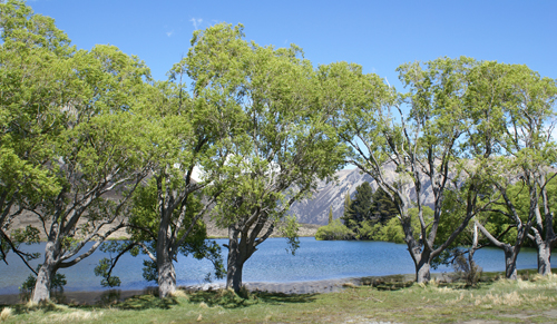
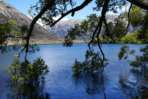
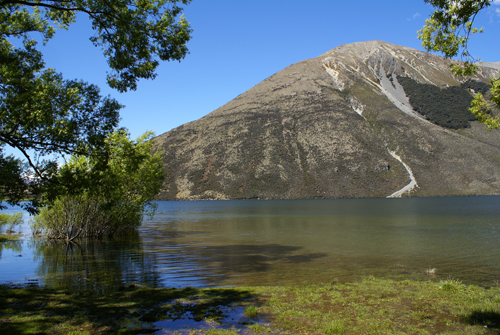
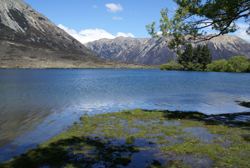
Lake Pearson are both good trout fishing spots. lake Pearson is also known for tis beautiful mountain reflections, which unfortunately were marred by the stiff breeze that was blowing and rippling the surface of the lake. Known as Oporea to the Maori, every year groups of the Canterbury Ngai Tahu Maori camped at the shores the lake. This was one of many places where they gather seasonal resources to supplement winter food supplies and to trade with other groups. Lake Pearson was on a network of trails that linked sites for gathering different foods in inland Canterbury. These mahinga kai sites were named, forming part of a memorized sequence of places and landmarks. Resources from each mahinga kai area were allocated to family groups. these groups were responsible for passing on the knowledge, customs, and stories associated with each food and familiarizing the next generation with the trails and tribal boundaries.
During the summer-autumn moult season, the Maori hunters drove large numbers of waterfowl (sometimes using dogs) into pens where they could be killed easily. they were cooked and preserved in their own fat. Lake Pearson is one of the few homes to the Southern crested grebe (kamana, or treasure, to the Maori), which is now close to extinction.
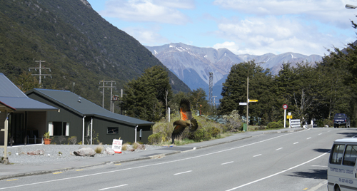
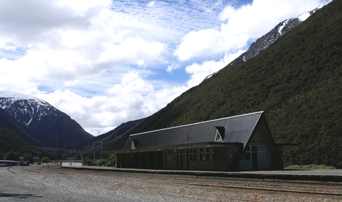
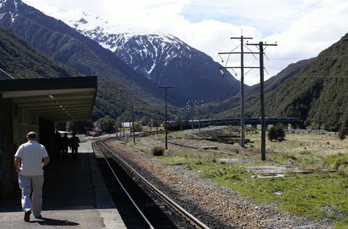
The village of Arthur's Pass is nestled in a valley about 5 km east of the summit of Arthur's Pass. It was originally the camping site of contractors engaged to push the road through from Christchurch to the West Coast in 1865-6. In 1908, workers at Arthur's Pass village and at Otira, on the westerns side of the Main Divide, began construction of the 8 km Otira rail tunnel. In 1912, the population of Arthur's Pass had swelled to about 300, comprised mainly of tunnel workers. It took 10 years for the two ends of the tunnel to meet, and another five years before the first train travelled through it. A number of tunnellers' cottages remain in the village, now used as private holiday homes.
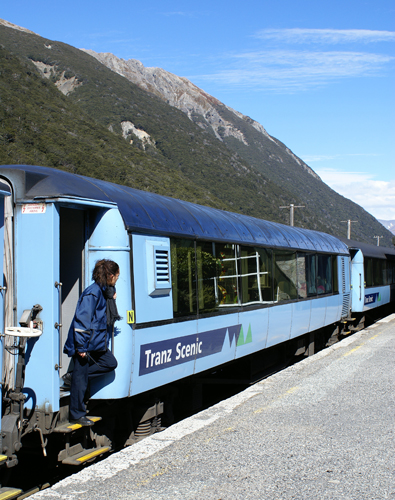
Since the 1920's, the village has been a base for day trippers from Christchurch and Greymouth, walkers, trampers, and mountaineers, as well as skiers who enjoy the splendid views and low key atmosphere of the nearby Temple Basin ski field. It is also the headquarter for Arthur's Pass National Park. Today we waited for the arrival of the afternoon train and loaded our two ABCA'ers on board for their return to Christchurch, as we continued on westwards toward Greymouth.
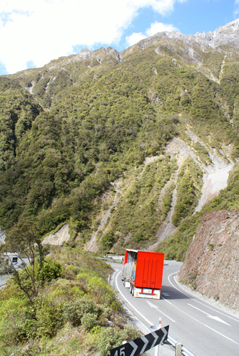
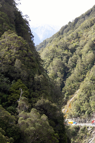
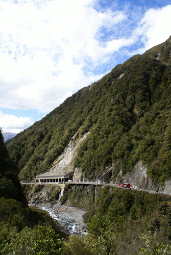
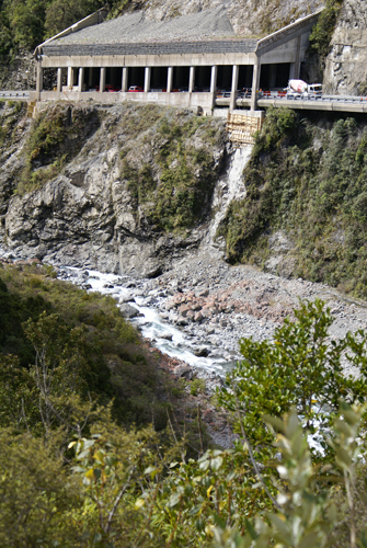
Below you can see the Otira River Gorge. There was work being done on some of the road coverings in areas where streams were feeding into the river and where rock slides from the surrounding mountains were common. This section of Highway 73 included the Otira Viaduct which was completed in 1999 and spans the Otira River. The road drops of much more steeply on the west side of the mountains so the breaks and the transmission on the camper van got quite a workout. As did my skill at driving on the left side of the road and shifting gears with a manual transmission with my left hand.
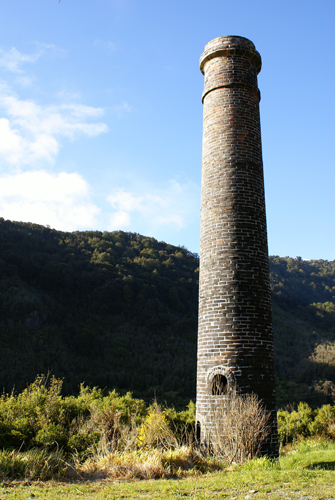
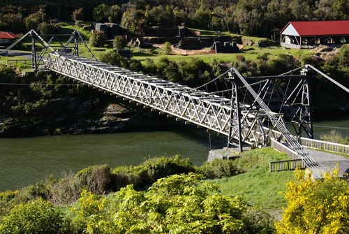
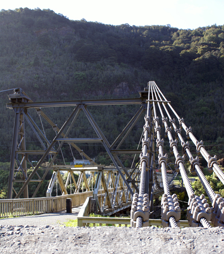
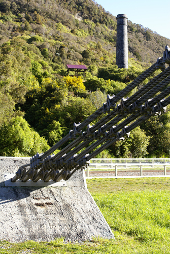
Between Stillwater and Greymouth on the Grey River we saw this unmarked chimney on the side of the road. Once we stopped, we saw a small path leading down the river bank that quickly opened up to reveal this bridge across the river to an old coal mine.
The chimney replaced an earlier iron one and was originally associated with the Tyneside mine on the south bank of the river. In the 1930's it served the purpose of a brickshed chimney.
Coal was first discovered on the West Coast by explorer Thomas Brunner in 1848. the largest of the early mines were on the Denniston and Stockton plateaus, north-east of Westport, where large scale exploitation began in 1878.
This mine, named after Brunner, was opened in 1864 and operated into the 1900's. It was one of New Zealand's most productive coal mines with a peak annual production of 129,555 tonnes of coal. High quality coal for industrial and domestic purposes was shipped to all parts o f New Zealand. It was also th site of the country's worst mining disaster. On 26 March 1896, 65 men and boys were killed when there was an underground explosion in the mine.
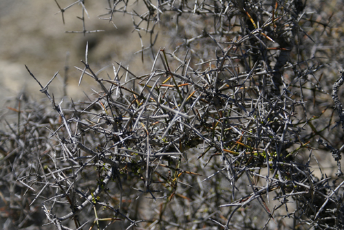
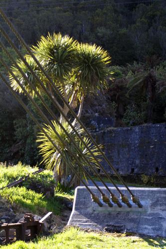
Below you can see a cabbage tree. These trees are found all over New Zealand. The cabbage tree is a familiar sight in swamps or dampish places throughout New Zealand vegetation. It is also planted occasionally in gardens and parks and has been introduced into horticulture overseas. It reaches heights of 40 ft at its maximum development with diameters of 1–4 ft. The crown is made up of long, bare branches carrying bushy heads of large, grass like leaves 2–3 ft long. Early settlers used the young leaves from the centre of these heads as a substitute for cabbage – hence the common name. At flowering time large panicles of small, white, sweet-scented flowers emerge from the centre of the heads. Good flowering seasons occur every few years only. It is said that they foretell dry summers but, from observation, they usually follow dry seasons. Small, whitish berries are formed which are readily eaten by birds. The tree is very tenacious of life, and chips of the wood or sections of the stem will readily shoot. The leaves contain a high percentage of long fibres which are occasionally extracted.

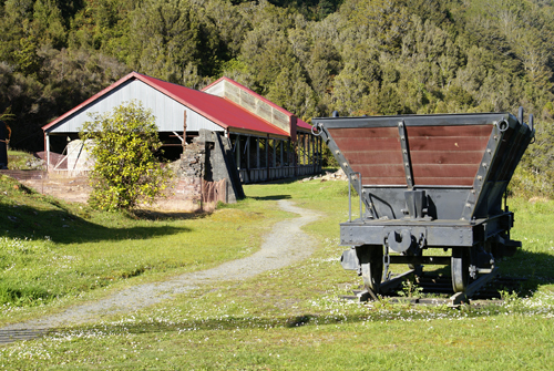
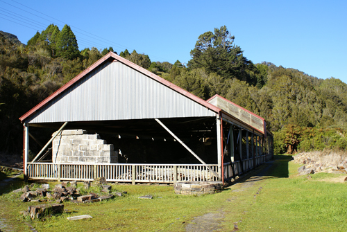
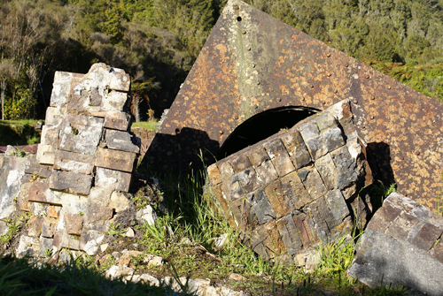
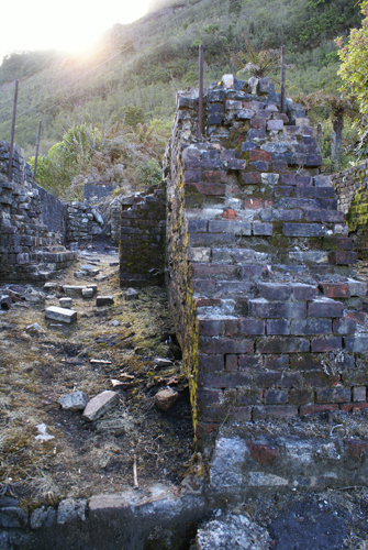
Coke and fire bricks were manufactured at Brunner for more than 50 years. Coke was manufactured from slack coal, while bricks were made form the fireclay found under the coal seam. The beehive coke ovens on the site are among the few examples of this type of oven remaining anywhere in the world. The remains of the beehive ovens can be seen under the frame structure above.
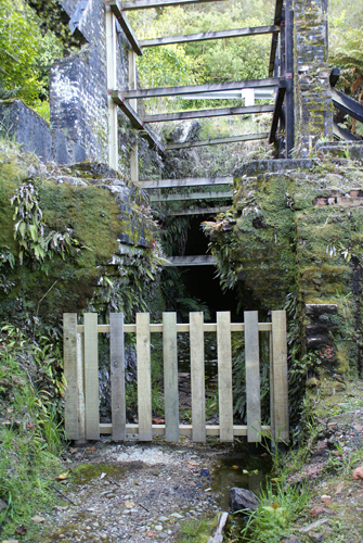
Below left is the mine opening. From here both rise and dip mining were conducted.
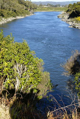
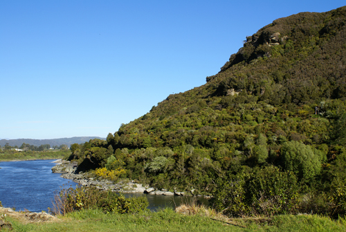
These two pictures show the Grey River flowing by the mine on its way to the Greymouth and the Tasman Sea.
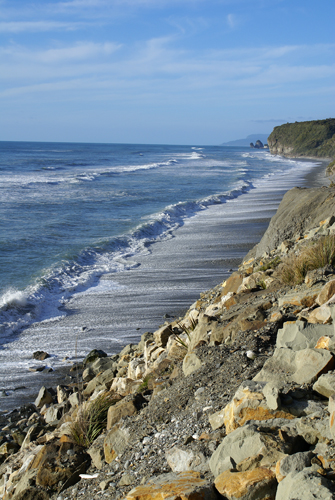
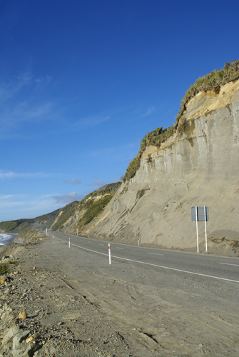
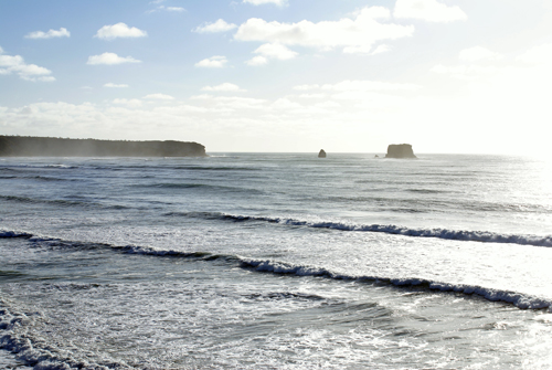
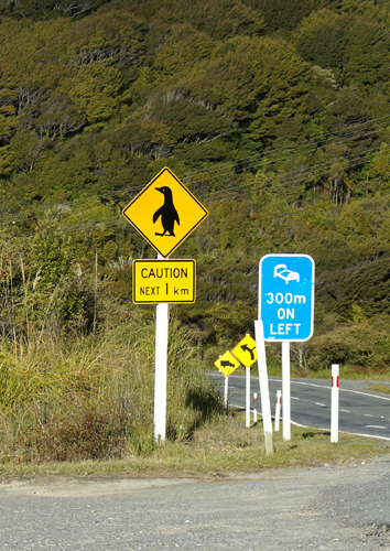
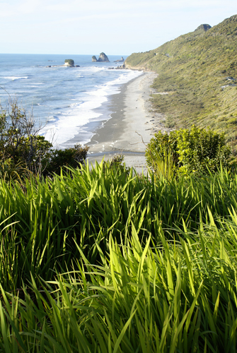
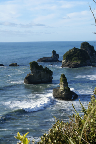
These shots show the coast along the Tasman Sea, and a caution to watch out for crossing penguins. We didn't see any cross as we drove.
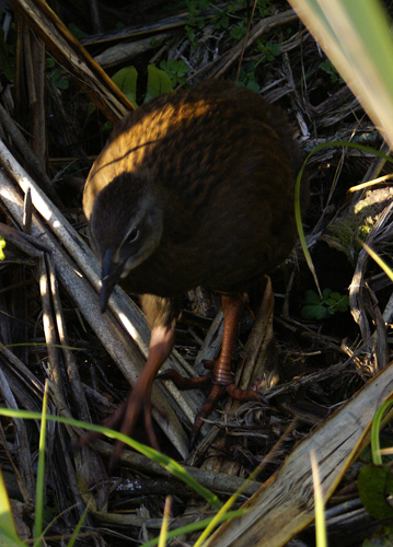
Below is a Weka (or Woodhen) which is a flightless bird species of the rail family only found in New Zealand.
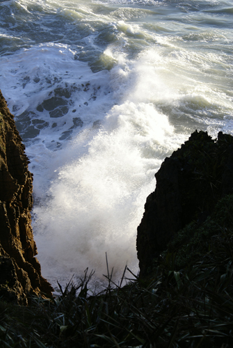
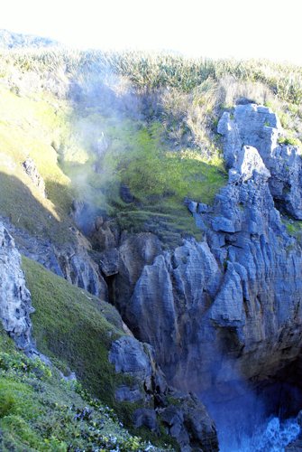
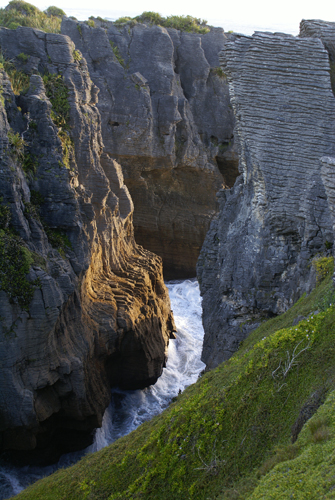
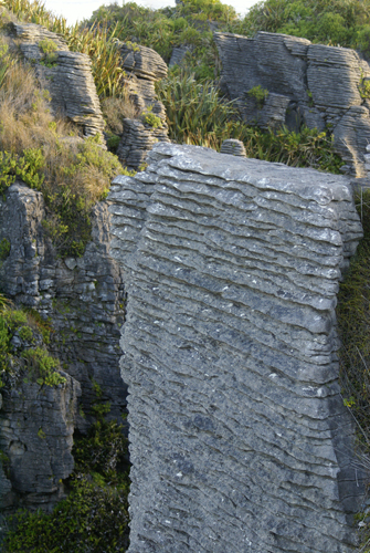
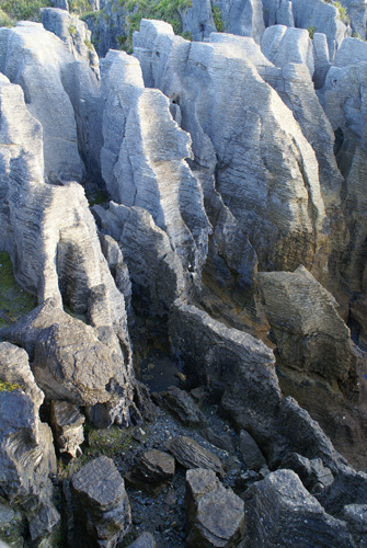
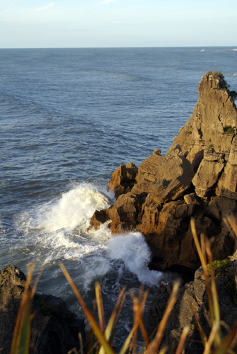
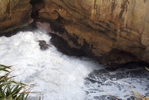
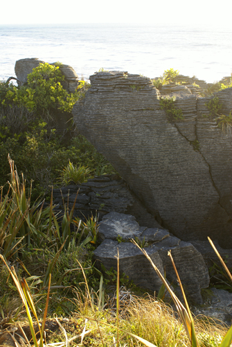
Further north on the coast just outside Punakaiki is the Pancake Rocks and Blowhole. Founded in 1987, this 300 sq km park contains varied and dramatic scenery, most famously the Pancake Rocks and blowhole. Bands of limestone, separated by thin bands of softer mudstone, which has been worn away by thousands of years or rain, wind and sea spray, have created the layered formations of the Pancake rocks.
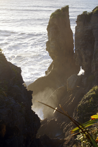
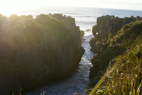
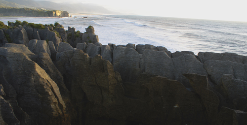
Over hundreds of thousands of years, caverns have also been formed as carbon dioxide-bearing rainwater has gradually eaten into cracks in the limestone. During high seas, these subterranean caverns become blowholes as the waves surge in under huge pressure and explode in a plume of spray. To the right you can see a plume of spray rising out of a blow hole.
After travelling for about 300 km through steep and winding mountain roads and winding coastal roads we found a place to park, made a quick dinner in the galley and called it a night.